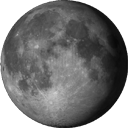
Virtual lunar Atlas is a program that allows us to observe and study the moon and its surface. It was developed by Christian Legrand and Patrick Chevalley. This program is basically developed for cheering special interest for astronomers, amateurs, and all those interested in exploring the Earth’s natural satellite- The Moon. Due to its precision and detail of its data, Virtual Lunar Atlas has won the recognition of astronomers and prestigious scientific publications. Now it is downloaded more than 500 000 times all over the globe. It has been referred in Chandrayaan 1 lunar mission preparation (India). It is also been recommended by the European Space Agency (ESA) and the French Ministry of National Education.
Photlun is picture manager which has changed the perspective of scientists and researchers towards geographical features of moon. This software allows us to modify pictures, photos of moon’s surfaces in a never done approach using programs that are inbuilt in it. This allows scientists to accurately plan landings of lunar modules or study characteristic features on the surface of moon.
Photlun is basically a Virtual Lunar Atlas which help in finding and studying selected topographical areas on moon. This atlas also contains some 3D views of areas, can be used to check the longitude, latitude and elevation of craters on surfaces with the specific programs available. Even pictures of a surface that is not clearly visible on some areas can be improved by enhancing the brightness, contrast and sharpness or enlarge by its specific commands and features.
a)In this snapshot of working of PhotLun one can study the topology in detail as never done before.
b)One of the many high quality pictures provided by PhotLun. You can clearly verify its unique resolution power.
The latest super- high resolution LOPAM texture built on USGS data improves a lot formations regarding findings and vision
This software gives an added advantage by proving 450 High Resolution [HD] images of lunar surfaces taken through various satellites which orbit moon. Its powerful software configuration is compatible with many operating systems including MacOS and Windows Vista thus enhancing its adaptability and compatibility with latest hardware in the market.
The program’s basic interface is available in two languages i.e. English and French, however extra translations can be freely downloaded from the developers’ website.

